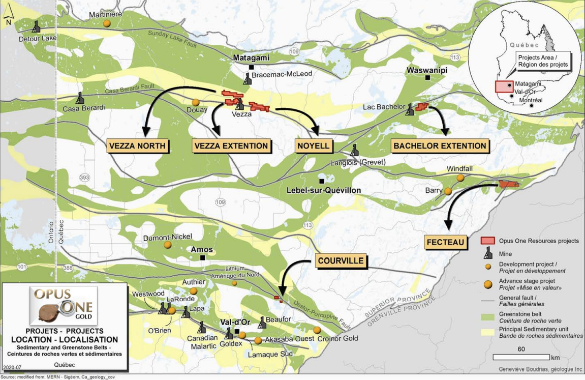
The Noyell property is located in the center of the Noyon township, 20 km south of the town of Matagami. It is accessed by using winter and forest roads (16 km) ending at kilometer 198 of Route 109 linking Amos to Matagami. The property is almost completely deforested, commercial wood having been cut during the winter of 1995.
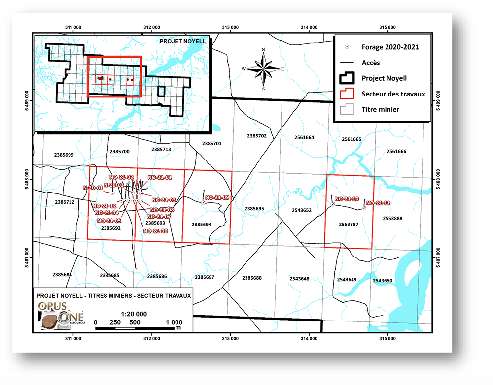
The Noyell property consists of 84 cells covering an area of 4,482.34 hectares in the Noyon and Le Tardif townships. It overlaps NTS 32F05, 32F06, 32F11 AND 32F12. The western half of the property was acquired from Magna Terra of Toronto while the eastern half was obtained by map staking between 2019 and 2021.
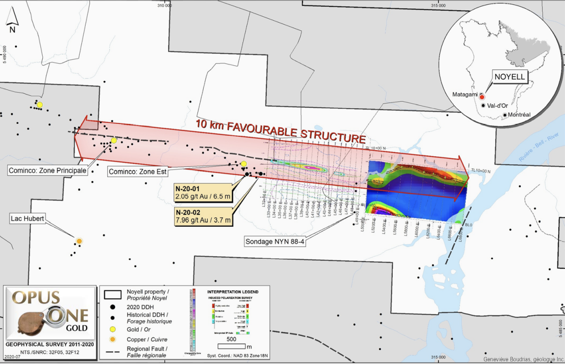
Previous work has been limited, because of the thick overburden cover, to geophysics and drilling. Airborne EM-Mag, EM-Mag and ground P.P. surveys cover the west of the property. These surveys were followed by 76 diamond drill holes (41 by Cominco, 25 by SOQUEM and 10 by First Gold). This work led to the discovery of the East and West zones.
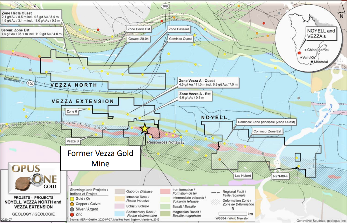
The Noyell property is located in the northwestern portion of the Abitibi subprovince of the Superior province. It is found within the Archean volcano-sedimentary belt of Vezza-Bruneau (Dussault, ‘90) which is part of the volcano-sedimentary and plutonic basin of Harricana-Turgeon (Lacroix, ‘89).
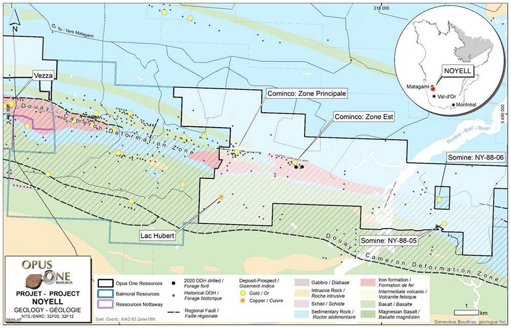
More precisely, it is placed on the southern edge of the Taïbi sedimentary group at its contact with the Cartwright volcanics. These WNW-ESE (100-110°) south-dipping lithologies are constricted by the Bell River complex to the north, and the Marest pluton to the south. Regional greenschist facies metamorphism affects the entire region. The Noyell property is crossed from west to east by the Douay-Cameron regional deformation corridor. The latter has a high potential for discovering metalliferous deposits, as evidenced by the deposits that characterize it (Grevet, Flordin, Desjardins, Northway, Vezza and Douay).
On the property, there are two mineralized sectors, both located within the Douay-Cameron deformation corridor. The first is located in the western part of the property and extends approximately 600 meters in an east-west direction (local coordinates 0E to 600E). In general, the grades are sub-economic there, up to the studied depth of 300 m vertical. The deformation corridor was very little drilled between coordinates 600E and 2700E and very little encouragement was found there.
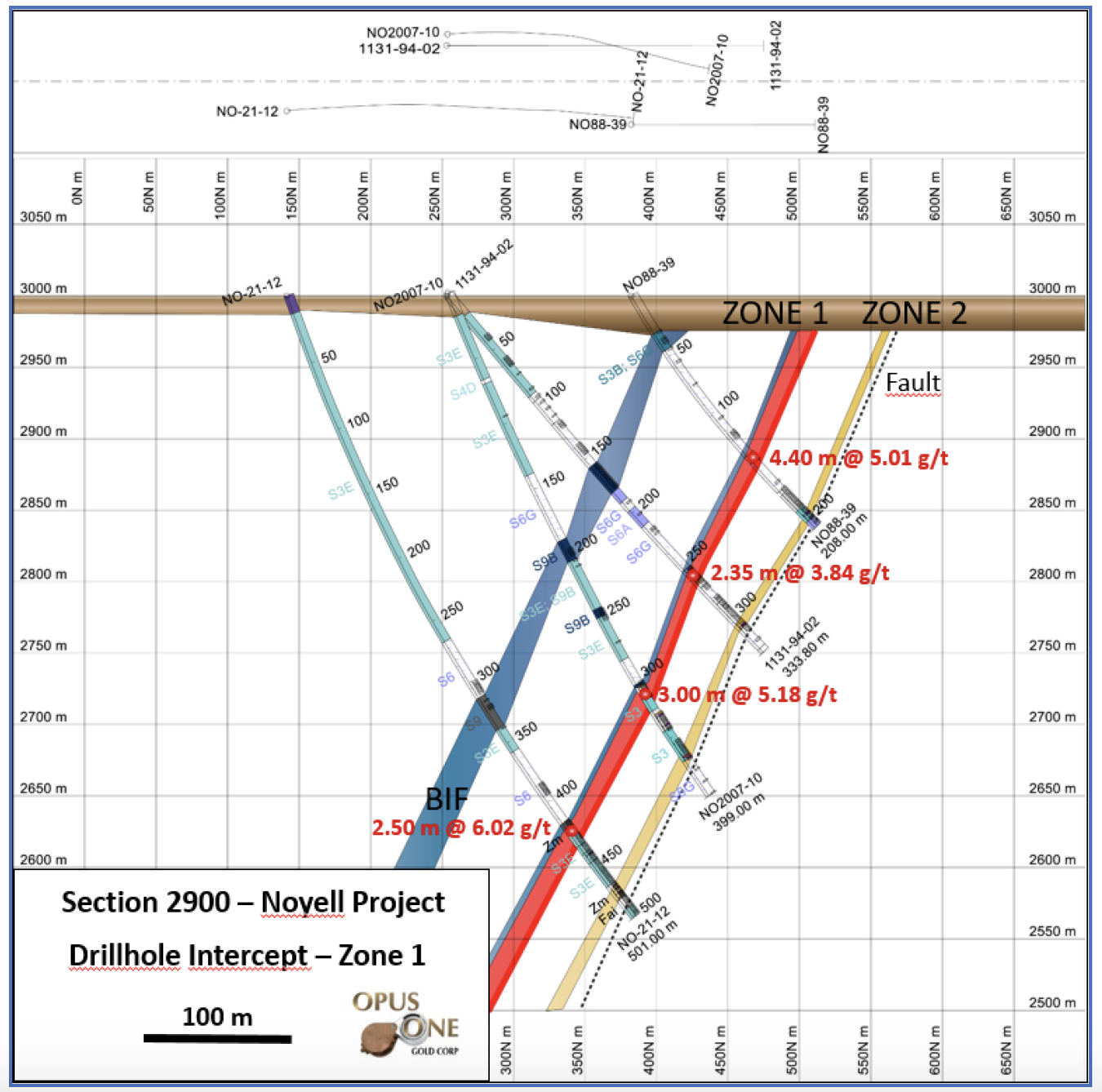
The second area of interest was discovered in the center of the property between coordinates 2800E and 3200E which represented the eastern limit of the original property below Cominco and Soquem. It was drilled to about 350 meters vertical depth. It hosts Zone 1, the site of the most recent drilling by Opus One Gold.
Characteristics of gold mineralization on the Noyell property:
- The gold mineralization is controlled by shears belonging to the Douay-Cameron deformation corridor.
- The brittle deformation sectors of the shear zones are more favourable to the development of mineralization than the ductile deformation sectors.
- Gold mineralization is mainly associated with silica and iron sulphide alteration.
- There is a strong positive correlation between the sulphide content, regardless of their nature (AS, PY, PO), and the Au concentration.
- The best values in enriched zones almost always accompany strongly deformed quartz-iron carbonate veins and veinlets (boudinaged, brecciated or folded).
- The mineralized zones are marked by a significant auriferous halo often exceeding 10 meters.
- Significant mineralization is located near geological contacts.
Description of mineralized horizons
Zone 1:
- It is represented by the contact zone between the metasediments and a thin horizon of oxide iron formation.
- We note a breccia zone at the contact between the metasediments and the lower wall of the iron formation.
- The zone is strongly invaded by centimetric quartz veins containing 15-20% PY-PO and 1-2% As agglomerated in clusters of sulphides. The area is also characterized by the abundance of iron carbonate.
- Zone 1 is the main level of this showing. It has very good continuity and high values 1-20 g/t Au. Its average thickness is about 3-4 m. Zone 1 is currently the main exploration target on the property.
Zone 2:
- It is represented by different levels of altered and sheared metasediments within the main deformation corridor.
- This type of mineralization can be found in several places inside the deformation corridor. It is generally located at the southern contact with an intense shear zone strongly sericitized and carbonatized in iron carbonate. The sheared zone is intensely invaded by boudinaged quartz-ankerite veins. It contains 3 to 5% PY and as much finely disseminated arsenopyrite along the foliation. A majority of drill holes ends in this shear zone.
- Horizon 2 is characterized by significant thicknesses (> 10 m) but the gold content is often marginal and rarely exceeds one gram/ton.
In 2020 the company Opus One completed two drill holes on the property for a total of 817m. In 2021, the company completed 12 holes for a total of 5,059.6 m.
A preliminary observation on the genesis of this gold deposit is that it appears that the presence of an oxide facies bedded iron formation (BIF) is necessary to mobilize the gold. The presence of a strong quartz-sulphide stockwork without BIF (like that observed in hole NO-21-07) is not sufficient to attract and retain the gold circulating in the hydrothermal system. Although not all BIFs are associated with gold anomalies, they are nevertheless a good exploration tool for our future drilling programs.
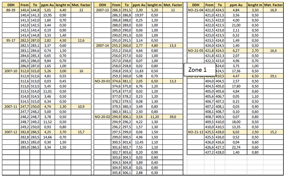
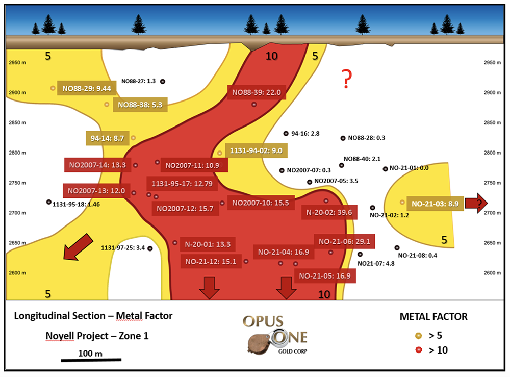
The table below shows all intersections (present and past) interpreted for Zone 1, historically called Cominco East, having a Metal Factor (grade X thickness) above 10. These are the values that we see in red on the longitudinal section of Zone 1.
In conclusion, the project has several very positive features:
- Easy access
- Near an urban mining center
- Close to infrastructure
- Shallow overburden
- Quality gold mineralization and good continuity
- Multi-metric and easy to recognize gold mineralization
- Simple and favorable geometry of the main mineralized zone
- Availability of mills within 100 km.
- Strong potential for discovery on other stratigraphic horizons
The drilling of Zone 1 should therefore continue at depth as well as laterally.